Seven Lakes Valley hike: Bohinj's best full-day trail
Triglav National Park: 7 Lakes Valley hiking tour
How difficult is the Seven Lakes Valley hike from Bohinj?
It is a strenuous full-day hike (7–9 hours, 1,200+ m elevation gain) on rocky trails. Good mountain boots required. Not suitable for beginners or young children. Best as a guided or well-prepared independent hike.
The Seven Lakes Valley: Slovenia’s most rewarding alpine hike
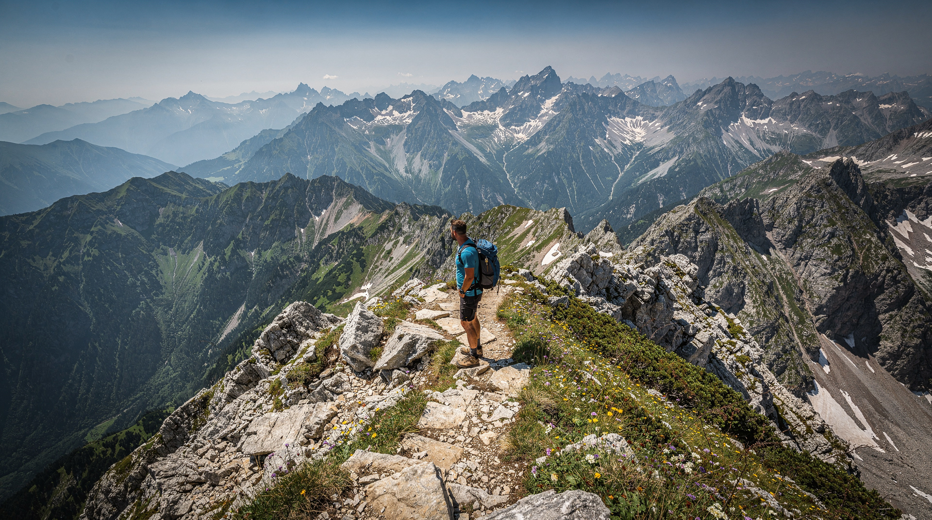
The Triglav Lakes Valley (Dolina Triglavskih jezer) contains seven permanent alpine lakes — and several seasonal ones — set on a limestone plateau between 1,300 and 1,990 metres. The route from Lake Bohinj to the highest lake and back is one of the finest full-day hikes in the Julian Alps: varied terrain, extraordinary scenery, and a genuine sense of remoteness despite the trail’s popularity.
This is not a casual walk. It is a serious mountain hike with significant elevation gain, rocky sections, and weather exposure on the upper plateau. It rewards prepared hikers with something genuinely extraordinary.
| Where | From Savica car park or Vogel cable car, near Lake Bohinj |
| Distance/gain | ~22 km round trip, ~1,200 m elevation gain |
| Time needed | 7–9 hours (shorter from Vogel) |
| Difficulty | Strenuous, red trail grade, mountain boots required |
| Best time | July–September; huts open mid-June to end September |
| Booking | Guide optional; huts need advance booking in peak season |
The lakes
The valley is named for seven permanent lakes, though the exact count depends on the season — some of the smaller basins hold water only in spring and early summer. The main lakes, from lowest to highest, are:
Črno jezero (Black Lake, 1,294 m): the first and lowest, named for its dark-forested surroundings. The water is typically a deep green rather than black, surrounded by dwarf pine.
Dvojno jezero (Double Lake, 1,339 m): two connected pools separated by a small land bridge, with clear shallow water over white limestone.
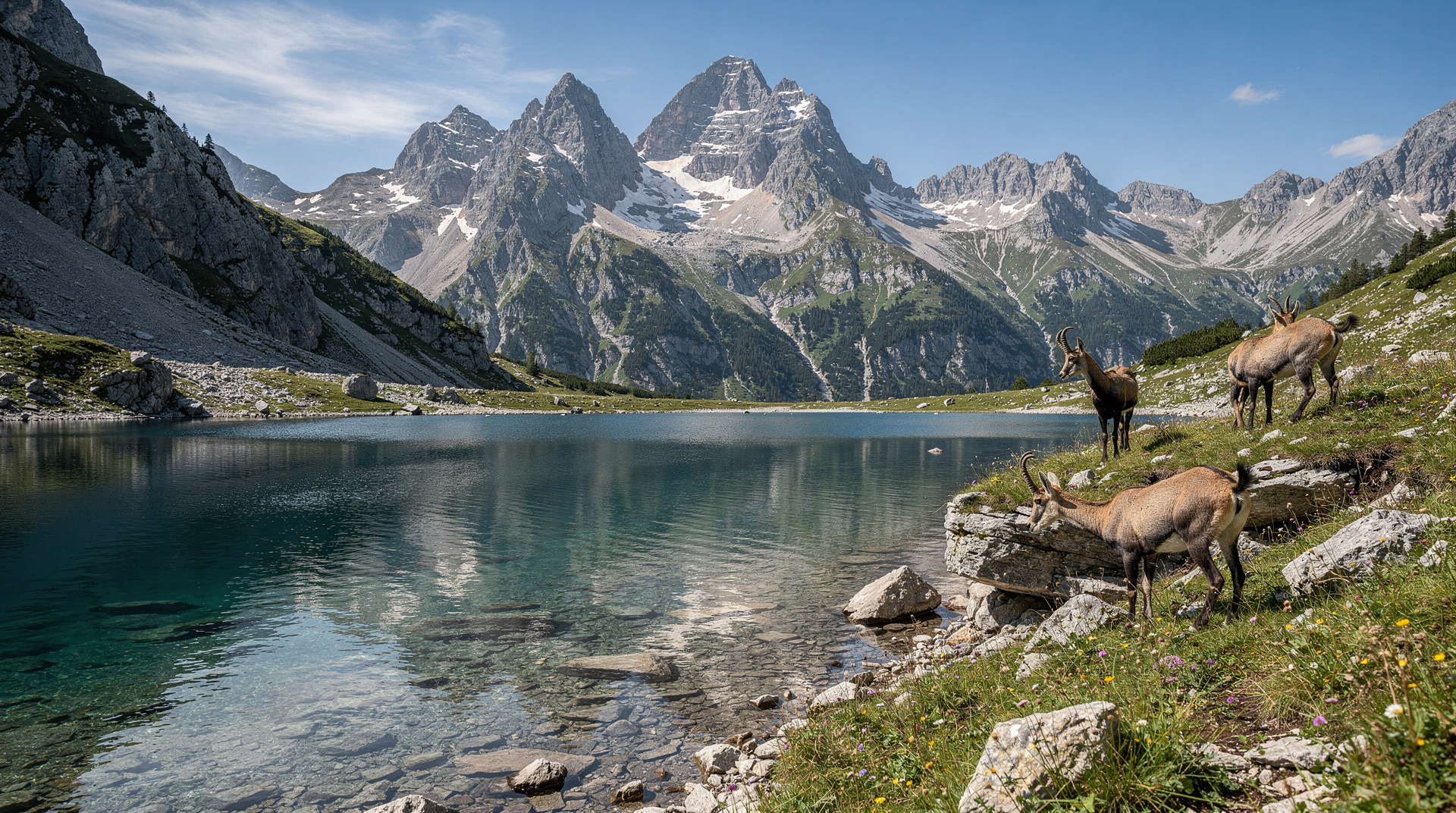
Triglavsko jezero (Triglav Lake, 1,541 m): the largest and most dramatic of the seven, sitting in an open limestone bowl with Triglav visible to the north. The mountain hut Koča pri Triglavskih jezerih (1,685 m) sits above this lake — the natural stop for lunch or overnight.
Rjavo jezero, Ledvica, Jezero v Lužnici: the upper three lakes, between 1,820 and 1,990 m, are smaller and more exposed. The highest (Jezero v Lužnici, 1,990 m) is often partially frozen in June and can disappear completely in dry summers.
Why this is the right hike for most people
The Seven Lakes Valley is the Julian Alps route that gives you everything the park does best in a single day: the gradual transition from forested valley to open limestone plateau, the sequence of increasingly wild lakes, the sight of the Triglav ridge above the upper valley, and the mountain hut experience at 1,685 m. It is harder than most first-timers expect, and more rewarding than most descriptions prepare you for.
It is also the right hike to do before attempting Triglav. The terrain above the Seven Lakes Hut — the upper plateau and the Hribarice approach — is the beginning of the Triglav routes. Doing the lakes valley first gives you a calibrated assessment of your own fitness and preparedness before committing to the summit.
The route from Bohinj
Starting point: the most common approach starts at the Savica Waterfall car park, near Ukanc at the western end of Lake Bohinj. From here, the path climbs steeply through forest to the Komna plateau (1,520 m) — this is the hard section, a relentless 500 m climb in about 1.5 hours. Alternatively, start from the Vogel cable car (EUR 15 return), which reduces the elevation gain significantly.
Via the Komna plateau: from the Komna plateau, the gradient eases. The Dom na Komni hut (1,520 m) is a natural rest stop. From Komna, a clear trail heads north into the lakes valley, descending slightly before the final climb to the upper lakes.
Distance and time: Savica car park to the highest lake and back is approximately 22 km with around 1,200 m of elevation gain. Allow 7–9 hours for the full return. The Vogel cable car start reduces distance by about 4 km and 400 m of gain.
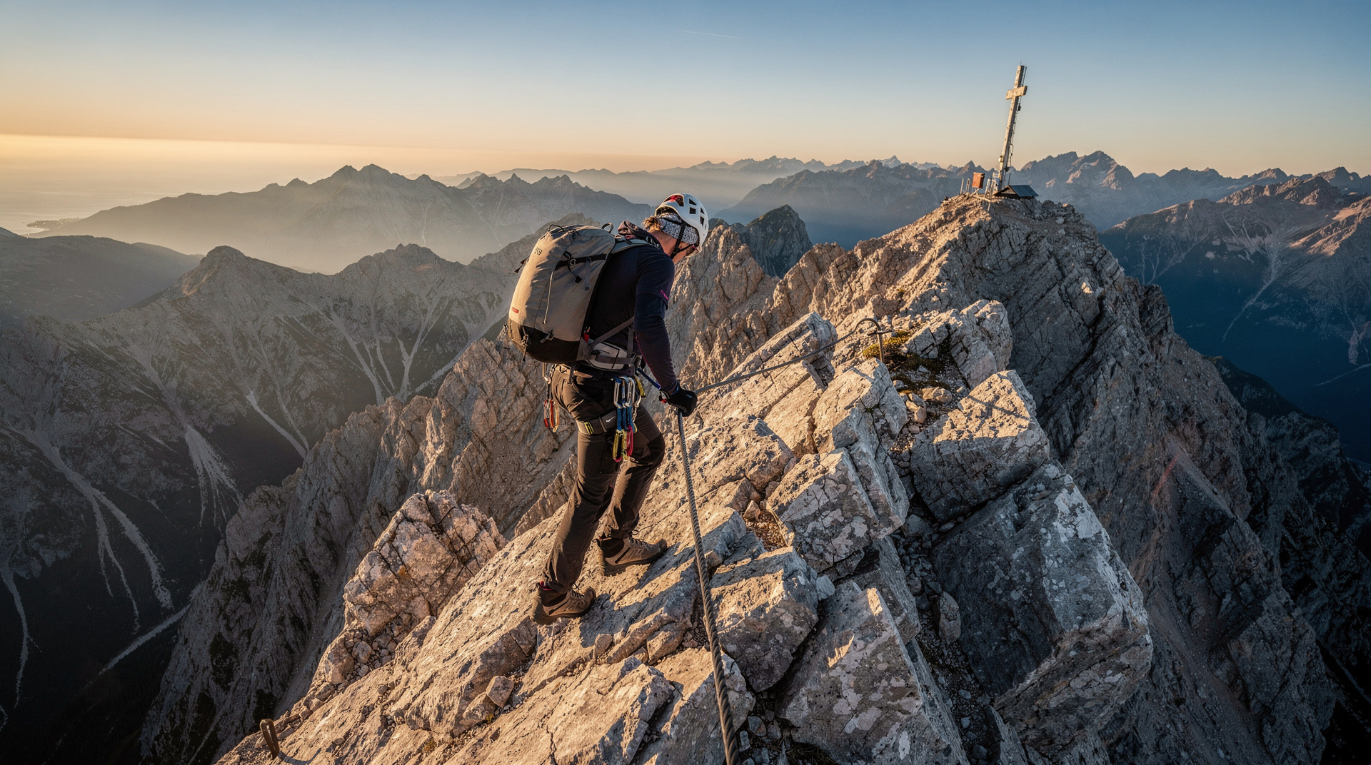
Trail grade: marked as a red trail — moderate to strenuous. The Komna ascent and the upper section above Triglavsko jezero are the hardest parts. No via-ferrata sections on this route (the via-ferrata begins if you continue toward Triglav from the upper lakes).
Turning the day hike into a multi-day route
The Seven Lakes Valley is perhaps best appreciated over two or three days, which allows you to go deeper into the park without rushing. The Koča pri Triglavskih jezerih hut (1,685 m) is a beautiful overnight stop — phone ahead in July and August, as it fills quickly. From the hut, you can continue the next day to the Hribarice plateau (2,358 m) and, with appropriate gear, push for the Triglav summit.
A classic two-day itinerary from Bohinj:
- Day 1: Savica car park → Komna → Seven Lakes hut (overnight)
- Day 2: Seven Lakes hut → upper lakes → Hribarice → (continue to Triglav) or return via Komna loop
Adding Triglav on day two requires via-ferrata experience and appropriate gear. If the summit isn’t the goal, the upper lakes and Hribarice viewpoint are reward enough.
Best time to hike
July and August: the huts are fully open, conditions are reliable, and the trail is at its most accessible. These months are also the busiest — the lower sections near Bohinj and Komna see significant foot traffic. The highest lakes are usually snow-free by mid-July.
June: the wildflowers on the Komna plateau are extraordinary in June, and the lower trail is quiet. However, the upper valley above 1,700 m may still carry snow patches, and the highest lakes may be partially frozen. Check with the mountain rescue or local guides for current conditions.
September: arguably the finest month for this hike. The light is warm and directional, the crowds are much thinner, and the huts are still open through the month. The highest lakes are fully accessible and the autumn colours on the surrounding hillsides are beginning.
October: the huts typically close in early to mid-October. The lower sections of the trail can still be hiked, but the upper valley should only be attempted with experience and awareness of early snowfall risk.
What to bring
The valley sits on a karst limestone plateau that gives minimal shelter from sudden weather changes. Even in July, conditions above 1,800 m can change within an hour. Pack:
- Mountain boots (not trail runners — the limestone is sharp and uneven)
- Waterproof jacket and warm layer (temperatures at the upper lakes are typically 8–12°C below the valley)
- 2 litres of water minimum (the huts sell water and food)
- Sun protection (the plateau has no shade above 1,700 m)
- The 1:25,000 Triglav National Park map
Going with a guide
The Seven Lakes Valley is one of the most popular guided hikes in the park. A guide adds route knowledge, pace management, and the ability to adjust the route based on conditions. The guided Seven Lakes Valley hike from Bohinj is a full-day option with a local guide, covering the main lakes and the Komna plateau. For a broader introduction to the park that includes the Bohinj area, Julian Alps hiking tours from Bled offer flexible routing.
Getting to the start
From Bled: a regular Arriva bus runs from Bled to Bohinj (Ribčev Laz, 30 min, EUR 3). From Ribčev Laz, there is a local bus or taxi to the Savica car park (15 min). Alternatively, the Vogel cable car departs from near Ukanc — check the current bus schedule at the Bled bus station.
By car: from Bled, drive west along the Bohinj road (35 min). The Savica car park is signed at the Ukanc junction. Parking costs EUR 5 for the day.
From Ljubljana: change at Bled, or take a direct bus to Bohinjska Bistrica (about 2h, EUR 8) and connect to the Savica car park.
What this hike is not
The Seven Lakes Valley is not the route to Triglav — it passes through the approach zone, but the summit is a separate undertaking requiring via-ferrata gear. The valley itself, up to the highest lake, involves no via-ferrata. But it is also not a family walk: the Komna ascent is steep and sustained, and the upper plateau is exposed to weather. Fit beginners with mountain boots and a full day can do it; it is not appropriate for children under 10 or anyone without hiking experience.
If you want a shorter, gentler introduction to the Bohinj area, the Vogel cable car + plateau walk above the lake is a far less demanding option and still gives a strong sense of the park. The Pokljuka Plateau is the right choice for families or those wanting altitude without the elevation gain.
The geology of the lakes
The Triglav Lakes Valley sits on a karst limestone plateau — the same geological formation that underlies most of the Julian Alps. The lakes form because the underlying rock contains clay lenses: impermeable layers that prevent the water draining through the limestone. Where the clay is absent, the limestone drains freely (you’ll notice “dry lakes” — hollow basins without water — on the plateau above the main lakes). The lakes are therefore not permanent geological features in the long-term sense; as the clay lenses erode and the limestone drainage improves, individual lakes disappear over centuries.
The result is a landscape that changes subtly from decade to decade. The small upper lakes (Ledvica and Jezero v Lužnici) are noticeably smaller than they were in photographs from 50 years ago. Climate change is accelerating the trend: warmer, drier summers reduce the snowmelt that recharges the higher basins. The conservation value of the valley is partly about preserving a geological record of how the Alps once looked.
Flora and fauna
The karst plateau of the lakes valley supports an unusual variety of alpine plants adapted to the thin, calcium-rich soils. In June, the Komna plateau below the lakes blooms with gentians (the royal blue Gentiana clusii grows directly on limestone rock), narcissus, and alpine clover. The higher sections have cushion plants — compact mats of moss campion and cress — evolved to minimise wind exposure.
The valley is one of the few places in the Julian Alps where the endemic Zois’ bellflower (Campanula zoysii) grows — a tiny, pale blue flower found only in the Eastern Alps. Look for it in narrow cliff cracks above 1,800 m.
For fauna: chamois (alpine goat-antelope) are regularly seen on the ridges above the lakes, particularly in the early morning. Alpine chough (large black crows with yellow beaks) are present throughout the valley in summer. Brown bears theoretically range through the park but sightings near the main trail are extremely rare. The birdlife on the Komna plateau includes several woodpecker species and, with luck, the golden eagle.
Hut accommodation details
Koča pri Triglavskih jezerih (1,685 m): the Seven Lakes Hut, run by the Slovenian Mountain Association (PZS), is the most visited overnight stop in this valley. Built in 1928 and substantially renovated since, it has dormitory accommodation for approximately 90 people and a small number of semi-private berths. Dinner (set meal, typically goulash or stew) and breakfast are included in the overnight rate or available separately. The hut is open approximately mid-June to end September; outside this window, an emergency shelter section is left unlocked.
Reservations: book by phone at least 3–4 weeks ahead for July and August; the hut fills quickly on weekends. Contact through the Slovenian Mountain Association website.
Dom na Komni (1,520 m): the Komna hut, lower on the approach, is a popular lunch stop and offers accommodation as an alternative to the higher Seven Lakes Hut. Slightly more comfortable, with better toilet facilities. Also bookable through PZS.
Dom Planika na Kredarici (2,401 m): for those continuing to Triglav, the Planika hut is the highest staffed hut and the standard summit launch point. Limited capacity (around 60 beds) makes booking essential in peak season. Open June to October.
Navigation and waymarking
The route to the Seven Lakes Valley is well-marked from Bohinj with red-and-white blazes. The main trail junctions have wooden signposts with distances and times. However, above 1,600 m in mist or rain, visibility can drop to a few metres and the signposting becomes sparse. The 1:25,000 Triglav National Park map (Kartografija) covers the entire valley at sufficient detail for navigation in poor visibility. A compass or GPS backup is useful for the upper plateau in cloud — the limestone terrain has few distinctive features.
The trail from the Seven Lakes Hut to the Hribarice plateau (2,358 m) involves one section of steep, unmarked scree that is harder to follow in fog. If conditions are poor above the hut, this is the section where people most often go off-route.
What this hike is not
The Seven Lakes Valley is not the route to Triglav — it passes through the approach zone, but the summit is a separate undertaking requiring via-ferrata gear. The valley itself, up to the highest lake, involves no via-ferrata. But it is also not a family walk: the Komna ascent is steep and sustained, and the upper plateau is exposed to weather. Fit beginners with mountain boots and a full day can do it; it is not appropriate for children under 10 or anyone without hiking experience.
If you want a shorter, gentler introduction to the Bohinj area, the Vogel cable car and plateau walk is a far less demanding option that still gives a strong sense of the park. The Pokljuka Plateau is the right choice for families or those wanting altitude without the elevation gain.
A day in the valley — what to expect hour by hour
A typical day starting from the Savica car park (8am start):
08:00 — Savica car park, begin the Komna ascent on the well-marked forest trail. 09:30 — Komna plateau (1,520 m). Rest at Dom na Komni hut if it’s open. The plateau opens up ahead of you — limestone grassland, no trees, views to Triglav ridge for the first time. 10:00 — Begin the descent into the upper Triglav Lakes Valley. The first lake (Črno jezero) appears at around 10:20. 10:30 — Dvojno jezero. The water clarity here is striking; the limestone bed is visible at 3 m depth. 11:00 — Triglavsko jezero, the largest lake.
If weather is good, this is the natural lunch stop before the Seven Lakes Hut above. 11:30 — Seven Lakes Hut (Koča pri Triglavskih jezerih, 1,685 m). Lunch. Rest. On a clear day, the view from the hut terrace across the valley and toward the Triglav skyline is the best in the valley. 12:30 — Continue toward the upper lakes if you have the energy and weather is stable. The upper three lakes are 45 minutes to 1.5 hours above the hut. 14:00 — Begin descent. The return via the same route (Komna) takes about 2.5–3 hours. 17:00 — Back at the Savica car park.
This is a long day but manageable. The Vogel cable car start (see above) allows a later departure (9:00–9:30) and shaves an hour off the total.
For context on the broader park and its trail network, see the Triglav National Park guide and the Julian Alps hiking guide. For an honest comparison of this route against other major hikes in the country, see best hikes in Slovenia.
Frequently asked questions about Seven Lakes Valley hike
Can I shorten the Seven Lakes Valley hike?
Yes. Starting from the Vogel cable car instead of the Savica car park cuts about 4 km and 400 m of elevation gain, letting you reach the lower lakes and Triglavsko jezero in a shorter day. Turning back at Triglavsko jezero rather than continuing to the upper three lakes also significantly reduces the total time and effort.Do I need a guide for the Seven Lakes Valley hike?
Not strictly, if you're an experienced mountain hiker with a map and good weather — the trail is well waymarked. But a guide adds real value on pace management, weather judgement and route-finding above the Komna plateau in poor visibility, and is worth it for first-timers to Slovenian alpine terrain.
Top experiences
Bookable activities with verified prices and instant confirmation on GetYourGuide.