Mangart Saddle guide: Slovenia's highest driveable road
From Bled: guided day trip to Trenta Valley and Soča
Can any car drive the Mangart Saddle road?
The Mangart Saddle road is narrow with steep drop-offs and no guardrails on several sections. A standard car can manage it in good conditions, but it is not recommended for nervous drivers, larger vehicles, or in wet conditions. The road is closed from approximately November to May.
The road to Mangart Saddle: high, narrow, and completely worth it
| Where | Julian Alps, 8 km northeast of Bovec, Slovenia–Italy border |
| Cost | Around EUR 7/car entry fee (peak season); free rest of year |
| Time needed | 3–4 hours for the saddle + summit round trip |
| Getting there | Self-drive essential, or guided tour/taxi from Bovec |
| Best time | July–September, mornings only (afternoon storms common) |
Mangart in context: why this matters
Mangart (2,679 m) is the third highest peak in Slovenia, behind Triglav (2,864 m) and Škrlatica (2,740 m). Unlike Triglav, which is a Slovenian cultural landmark as much as a summit, Mangart is relatively unknown outside the country. This anonymity is partly its appeal: on a clear July day when the Triglav routes have queues at the via-ferrata sections and the Seven Lakes Valley hut is full, the Mangart Saddle road may have only a dozen cars at the summit.
The combination of the driveable road to 2,055 m and the additional 624 m of hiking to the summit makes this one of the most accessible high-altitude experiences in the Julian Alps — you can be at 2,000 m by car with no prior hiking required, and on the summit by foot in under 3 hours from the parking area. For visitors with mixed fitness levels in a group, the saddle itself is a rewarding destination for those who don’t want to continue, while more motivated hikers push for the summit.
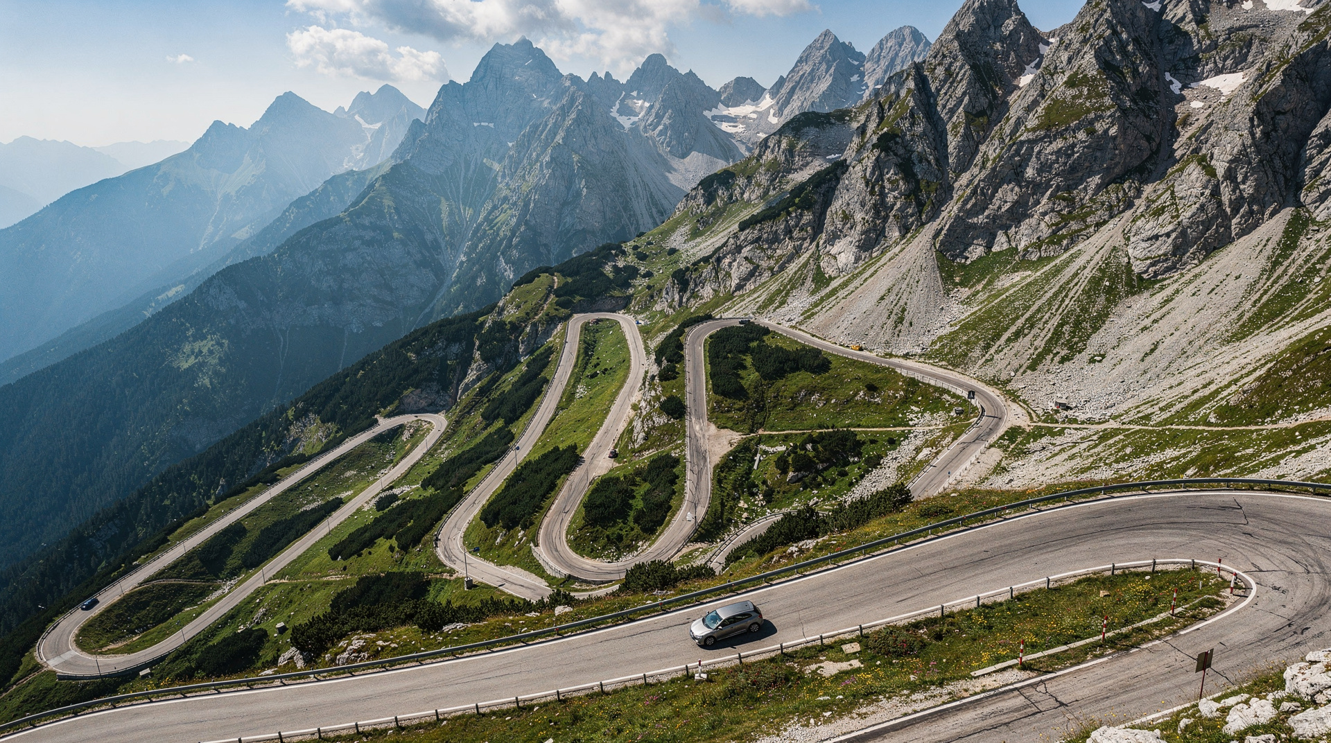
The Mangart Saddle (Mangartsko sedlo, 2,055 m) sits on the border between Slovenia and Italy in the Jalovec–Mangart–Montaž massif of the Julian Alps. The road that climbs to it is the highest public road in Slovenia, gaining 1,200 m from the valley floor in 12 km of switchbacks. It is narrow, has no guardrails on exposed sections, and it is one of the finest mountain drives in the Eastern Alps.
From the saddle, a trail continues to the summit of Mangart (2,679 m) — the third highest peak in Slovenia. The combination of the drive and the summit hike makes this one of the most spectacular full days you can have in the Soča Valley.
How the Mangart Saddle fits into a Soča Valley trip
Most visitors to the Soča Valley are there for one of three things: the river scenery and the Soča Trail, the adventure sports in Bovec, or the First World War history around Kobarid. The Mangart Saddle adds a fourth, complementary element: high-altitude alpine scenery that the valley floor doesn’t provide.
A well-structured 3-day Soča Valley programme might be: Day 1 — Vršič Pass arrival from the north, drive over the pass, arrive in the Trenta Valley and walk to the source of the Soča. Day 2 — Mangart Saddle in the morning (3–4 hours), Soča Trail section near Bovec in the afternoon. Day 3 — Kobarid, the Kobarid War Museum, and the Napoléon Bridge area before heading south or returning north.
This combination gives you the full range of the valley’s character without repetition. The Mangart day is the alpine counterpoint to the river-focused days.
The Mangart Saddle road: what to expect
The road starts near the village of Log pod Mangartom, approximately 8 km northeast of Bovec. From the junction with the main Bovec–Kranjska Gora road, follow signs for Mangart. The first few kilometres are paved and wide. Above about 1,200 m, the road narrows significantly — in places to barely one car’s width. There are passing places, but they require judgement.
Key characteristics:
- 12 km from junction to saddle, approximately 40–60 minutes driving
- Several sections with near-vertical drop-offs on one side and cliff on the other, no barriers
- In dry summer conditions, most drivers in a standard car manage it without difficulty, though not without tension
- In wet conditions, slippery limestone surface; in early season, possible snow on shaded upper sections
- Maximum gradient exceeds 15% on several stretches
- No fuel between the valley and the saddle
Honest assessment: if you are comfortable driving mountain roads in the Alps — the kind with serious consequences if you leave the tarmac — this road is manageable and the payoff is outstanding. If you are not comfortable with that kind of driving, it is better to go with a guided tour that handles the driving.
Vehicle notes: standard cars fine. SUVs and 4x4s comfortable. Campervans and motorhomes not recommended above 1,500 m. Caravans and trailers: do not attempt.
Seasonal closure: the road is closed from approximately November to late May, depending on snowfall. A barrier at the valley junction marks the closed status. Check conditions with the Bovec tourist office before setting out in early June.
Entry fee: a small environmental fee is charged at a booth approximately 2 km up the road during peak season (July–August). Approximately EUR 7 per car.
The geology of the saddle area
The Mangart-Jalovec massif is one of the oldest exposed rock formations in the Julian Alps — Triassic limestone and dolomite beds, approximately 230–250 million years old, laid down in a warm shallow sea that no longer exists. The same geological sequence underlies the entire Julian Alps, but the Mangart area exposes it at a particularly dramatic scale: the cliff faces above the Soča Valley show clear horizontal bedding lines visible from kilometres away, each representing centuries of marine sediment accumulation.
The saddle itself sits in a zone where the limestone beds have been folded and faulted by the tectonic compression that uplifted the Alps. The east-west orientation of the saddle follows a fault line. The rocks you walk on at the saddle are the top surface of a tilted limestone slab that continues kilometres in each direction.
The karst landscape visible from the saddle — the limestone sink holes, dry valleys, and weathered grey rock surfaces — is the result of 20,000 years of surface weathering since the last glaciers retreated. The glaciers themselves carved the Soča Valley into its present U-shape; the Mangart massif was above the ice line during the last glacial maximum and shows a different, more angular weathering pattern than the valley walls below.
The saddle itself
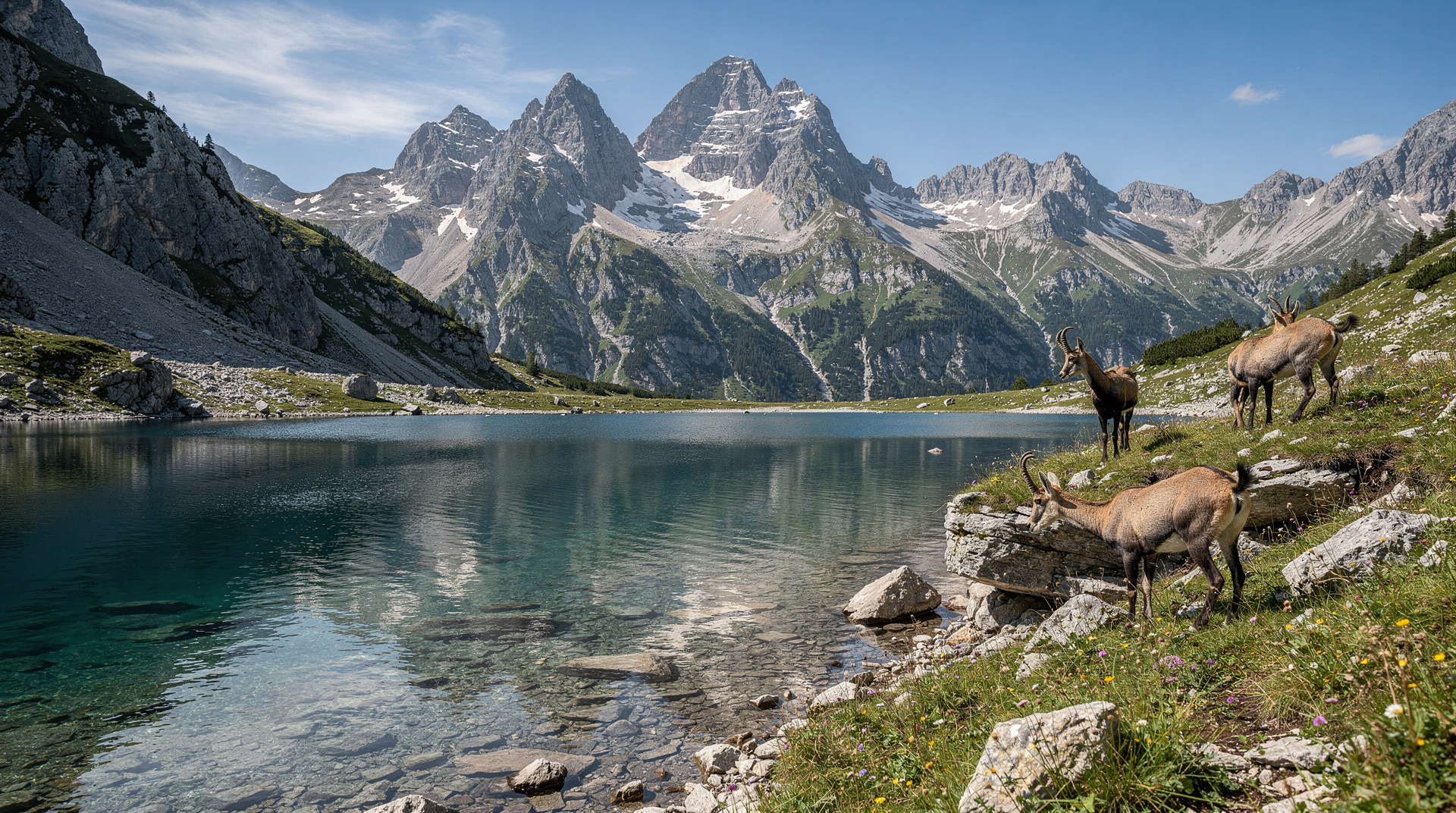
The Mangart Saddle is a broad, rocky pass at 2,055 m. The views from the car park are immediately extraordinary: to the east, the Julian Alps stretch back toward Triglav; to the west, the Italian Friuli plains are visible on clear days; to the north, the Mangart summit rises steeply. A simple mountain hut (Koča pod Mangartom) at the saddle serves food and drinks.
The saddle is on the former front line of the Isonzo (Soča) campaign of the First World War — the Italian and Austro-Hungarian armies fought at altitudes above 2,000 m in this area from 1915 to 1917. Remnants of trenches and fortifications are visible on the ridge, particularly on the Italian side. The Slovenian section of the Julian Alps between Mangart and Bovec contains some of the densest concentration of First World War heritage in the Alps.
Hiking from the saddle
To the Mangart summit (2,679 m)
From the saddle car park, a marked trail climbs the south ridge to the summit — a round trip of 3–4 hours. The lower section is a steep scree path; the upper section involves some rocky scrambling and an exposed ridge walk. This is not a via-ferrata route in the technical sense, but confidence on steep terrain is required. The trail is marked with red-and-white blazes but is narrow in places.
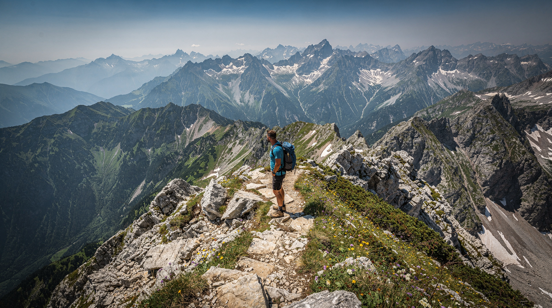
The summit view is one of the finest in the Julian Alps: Triglav to the east, the Soča Valley below to the south, the Italian Dolomites to the west on clear days. On an exceptionally clear morning, the Adriatic coast is visible to the southwest.
Difficulty: strenuous, requiring solid fitness and mountain boots. The final 200 m of height gain involves steep loose rock and requires care. Not suitable for beginners or children.
Best conditions: July to September. The upper section can hold snow into July in a heavy winter; check with the Bovec tourist office for current conditions in early season.
Summit ridge traverse: experienced mountain hikers can continue along the ridge from Mangart into Italy — the trail continues to Cima Mangart (same height, different aspect) and further along the border. This requires navigational ability and a longer commitment.
Combining with the Soča Valley
The Mangart Saddle makes most sense as part of a Bovec/Soča Valley day. A natural combination:
- Morning: drive the Mangart road, hike to the saddle viewpoint or the summit
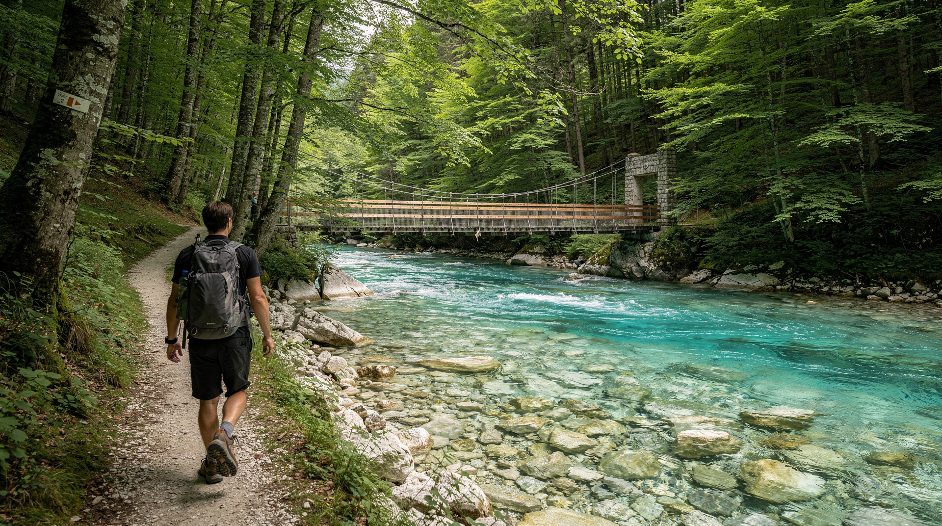
- Afternoon: drive down, then spend the afternoon on the Soča Trail (riverside walk) or at one of the emerald pools near Bovec
- Evening: dinner in Bovec
The Soča Trail guide covers the riverside route in detail.
Alternatively, driving from Kranjska Gora over Vršič Pass to the Trenta Valley, then continuing to Bovec and the Mangart Saddle, makes a full one-day circuit of the western Julian Alps — one of the finest drives in Slovenia.
How to get there without a car
The Mangart Saddle road is not served by public transport. If you don’t have a car, the options are a guided tour (which handles the driving and logistics) or a taxi from Bovec (approximately EUR 30–40 each way). Guided tours that include Mangart typically do so as part of a broader Soča Valley or Julian Alps programme. Julian Alps and Trenta Valley tours from Bled sometimes include the Mangart area; check the specific itinerary. The Best of Julian Alps tours via Kranjska Gora cover the north side of the same massif and occasionally include the Mangart approach.
The Soča Valley adventures: combining Mangart with rafting
Bovec is Slovenia’s outdoor adventure capital. The Soča river rafting and kayaking operations in Bovec are well-organised, safe (for the commercial sections), and give an entirely different perspective on the same valley you walked beside on the Soča Trail. Commercial rafting on the Soča costs approximately EUR 40–55 per person for a 2-hour half-day trip; operations include all equipment, a guide, and a river safety briefing.
After a morning on the Mangart Saddle road and summit, spending 2–3 hours in the afternoon on the river is a compelling combination — high altitude in the morning, the valley floor in the afternoon. Most Bovec rafting operators run afternoon sessions from 2–5pm.
The via-ferrata routes around Bovec (particularly the Kanin cable car route and the lower Soča canyon sections) are additional options for adventurous visitors with more days in the valley.
Practical notes
- Bring warm clothing even in July — the saddle is exposed and wind can make 2,000 m feel significantly colder than the valley
- Mountain boots essential for the summit trail; trail runners adequate for the saddle area only
- The hut at the saddle has limited capacity and may not be open early in the season
- The road is best driven in the morning before afternoon thunderstorms build (common in July and August)
- Mountain rescue (GRZS) covers the area; the emergency number is 112
- No mobile signal above about 1,600 m on the Mangart road
The Mangart massif: where Slovenia meets Italy
The Mangart (Italian: Monte Mangarte) straddles the Slovenian-Italian border at 2,679 m. The peak has two summits — the Slovenian and Italian — separated by a few hundred metres of ridge. From the Mangart Saddle, the border is visible as the ridge line dividing the two slope directions. The Italian side drops steeply into the Friuli Venezia Giulia region; on a clear day the Adriatic coast is visible 50 km to the southwest.
This borderland character gives the mountain a particular historical interest. During the First World War, the entire Julian Alps border region was contested between the Austro-Hungarian and Italian armies. The Isonzo (Soča) campaign (1915–1917) was fought along this frontier; the Mangart area, though not a main battle site, shows evidence of wartime engineering — military roads, fortifications, and observation posts that survive on the Italian side of the ridge.
The Italian Alpine Club (CAI) maintains huts on the Italian side of the Mangart massif. The SAV Mangart hut on the Italian slope is accessible from the saddle on foot and serves food in summer — an unusual possibility of crossing a European border on foot during a day hike.
Weather patterns and when to attempt the summit
The Mangart summit is exposed to both the continental climate from the north and the Mediterranean influence from the southwest. The result is that weather can change very quickly and the mountain can be in cloud while Bovec is sunny, or vice versa. The most reliable weather window on most days is 6–11am — afternoon cloud and thunderstorms are common in July and August from midday onward.
Wind is a significant factor on the exposed ridge above 2,400 m. The Bora wind (cold northeasterly) can arrive suddenly and violently in spring and autumn, making the saddle area uncomfortable and the summit ridge dangerous. Check the ARSO mountain forecast specifically for the Mangart/Bovec area (not the general Julian Alps forecast, which may not capture local conditions).
The best months for summit attempts: July and August in calm, settled conditions. September can be excellent but requires attention to the first autumn storms. The summit is achievable on a day trip from Bovec; the drive plus summit and back takes a full 7–8 hours.
After the hike: Bovec and the Soča Valley
After the physical effort of the Mangart Saddle road and the summit hike, Bovec is a natural place to recover. The town has several outdoor cafes and restaurants on the main square, ranging from quick pizza to proper gostilna meals. The Restavracija Martinov Hram (Trg golobarskih žrtev 8, Bovec) is a reliable local option for a dinner after a big mountain day.
For the evening: the Soča Valley’s thermal complexity means that even on warm days the valley cools dramatically after 6pm as cold air drains from the surrounding peaks. Bring a layer for the evening.
The Bovec area also has organized adventure activities — rafting, kayaking, via-ferrata, and paragliding — that can fill the remaining afternoon if the summit was achieved in the morning. Rafting companies operate until sunset in midsummer.
For an overview of the wider Soča Valley and its hiking options, see Soča Valley and the Soča Trail guide. For the broader Julian Alps context, see the Triglav National Park guide. For an honest ranking of how Mangart compares to other major Slovenian hikes, see best hikes in Slovenia.
Mangart vs. Vršič Pass: which drive to prioritise
Visitors with only one high mountain road on their itinerary often ask whether to choose Mangart or Vršič Pass. The honest comparison:
| Mangart Saddle | Vršič Pass | |
|---|---|---|
| Highest point | 2,055 m (road end; 2,679 m on foot) | 1,611 m |
| Traffic | Light, even in August | Busy, especially midday |
| Road character | Narrower, longer unguarded drop-offs | Wider hairpins, more forgiving |
| What you get at the top | A hike to a genuine summit | A pass with viewpoints, continues to Trenta |
| Best for | Drivers wanting solitude and a summit payoff | First-time visitors, less experienced mountain drivers |
If you can only do one, Vršič is the more forgiving introduction to Julian Alps driving; Mangart is the reward for those who want fewer people and a summit at the end of the road. Doing both on the same multi-day trip, as outlined above, gives the fullest picture of the range.
Groups with mixed confidence levels sometimes solve this by driving Vršič together and letting only the more experienced drivers continue to Mangart the following day, while the rest of the group spends the morning on the Soča Trail or in Bovec. This avoids putting a nervous passenger through a drive they won’t enjoy, without anyone missing out on the valley’s other highlights.
What to do if the weather turns
Because Mangart’s weather can flip quickly, it’s worth having a fallback. If cloud rolls in before you reach the saddle, turn back rather than push on blind — the road has no guardrails and visibility matters more here than almost anywhere else in Slovenia. A washed-out Mangart morning converts easily into a lower-altitude alternative: the Soča Trail riverside walk near Bovec, or the Kobarid war history sites, both unaffected by the cloud ceiling that closes off the high peaks. Check the ARSO Mangart-specific forecast the evening before and again at breakfast, and treat a “maybe” forecast as a reason to start earlier rather than later — mornings are consistently calmer than afternoons.
Frequently asked questions about Mangart Saddle guide
Is the Mangart Saddle road more difficult than Vršič Pass?
Yes, generally. Vršič Pass is busier, wider in most sections and has more traffic to set a pace by; the Mangart road is narrower, has longer unguarded drop-offs, and carries far fewer cars, so there's less reassurance from other drivers. Confident mountain drivers manage both without serious difficulty in dry summer conditions, but if you're nervous about exposed roads, Mangart is the harder of the two.Do I need to be an experienced hiker to reach the Mangart summit?
You need solid fitness and comfort on steep, loose rock rather than technical climbing skill — the route isn't a via ferrata, but the upper 200 m involves scrambling on scree with real exposure. Mountain boots are essential. Hikers who are comfortable with strenuous but non-technical Alpine trails elsewhere in the Julian Alps will manage it; complete beginners should stop at the saddle viewpoint instead of continuing to the summit.
Top experiences
Bookable activities with verified prices and instant confirmation on GetYourGuide.