Best day hikes in Slovenia: ten routes for every ability
| Difficulty range | Easy lakeside walks to Triglav summit (2864m) |
| Best season | May-June (flowers) or September (stable weather) |
| Cost | Most trails free; huts €12-18/night, meals €6-10 |
| Access | Car recommended for anything beyond Bled/Bohinj |
| Emergency number | 112 (mountain rescue, free of charge) |
A country built for walking
Slovenia’s geography — the Julian Alps in the northwest, the Soča Valley cutting south, the Kamnik-Savinja Alps to the northeast, and the Karst plateau in between — produces an exceptional density of hiking terrain within a small country. The Triglav National Park alone has over 800 km of marked trails.
These ten routes represent the full range: from flat lakeside walks suitable for families to serious Alpine ascents requiring mountaineering experience. Each entry includes an honest difficulty rating, access notes, and what the walk actually looks like.
1. Lake Bled circumference — easy
Distance: 6 km circuit
Time: 1h45 at a comfortable pace
Access: Bled village car park; bus from Ljubljana
The flat circuit of Lake Bled is the most-walked path in Slovenia. It passes through forest, along the water’s edge, and past the rowing club on the northwest shore. The south shore section — closer to the water, quieter, with Ojstrica viewpoint accessible via a short scramble — is the best 2 km.
Come early (before 7am) in summer. The Lake Bled guide has the trailhead map.
2. Ojstrica and Mala Osojnica viewpoints — easy-moderate
Distance: 4 km return
Time: 1h30
Access: Bled, south shore car park
The two viewpoints above the south shore of Lake Bled involve a short but steep scramble. Ojstrica (611 m) is the lower and more accessible; Mala Osojnica (685 m) adds another 20 minutes and a wider view. Both offer the classic Lake Bled photograph.
3. Savica Waterfall and Seven Lakes Valley — moderate to strenuous
Distance: 2 km return for the waterfall; 16 km one way to the Seven Lakes Valley top
Time: 1h for the waterfall; full day for the valley
Access: Ukanc parking at the western end of Lake Bohinj
The Savica Waterfall is a 30-minute walk from the car park, rising to a dramatic 78-metre cascade where the river emerges from limestone cliffs. This section is easy and suitable for all ages.
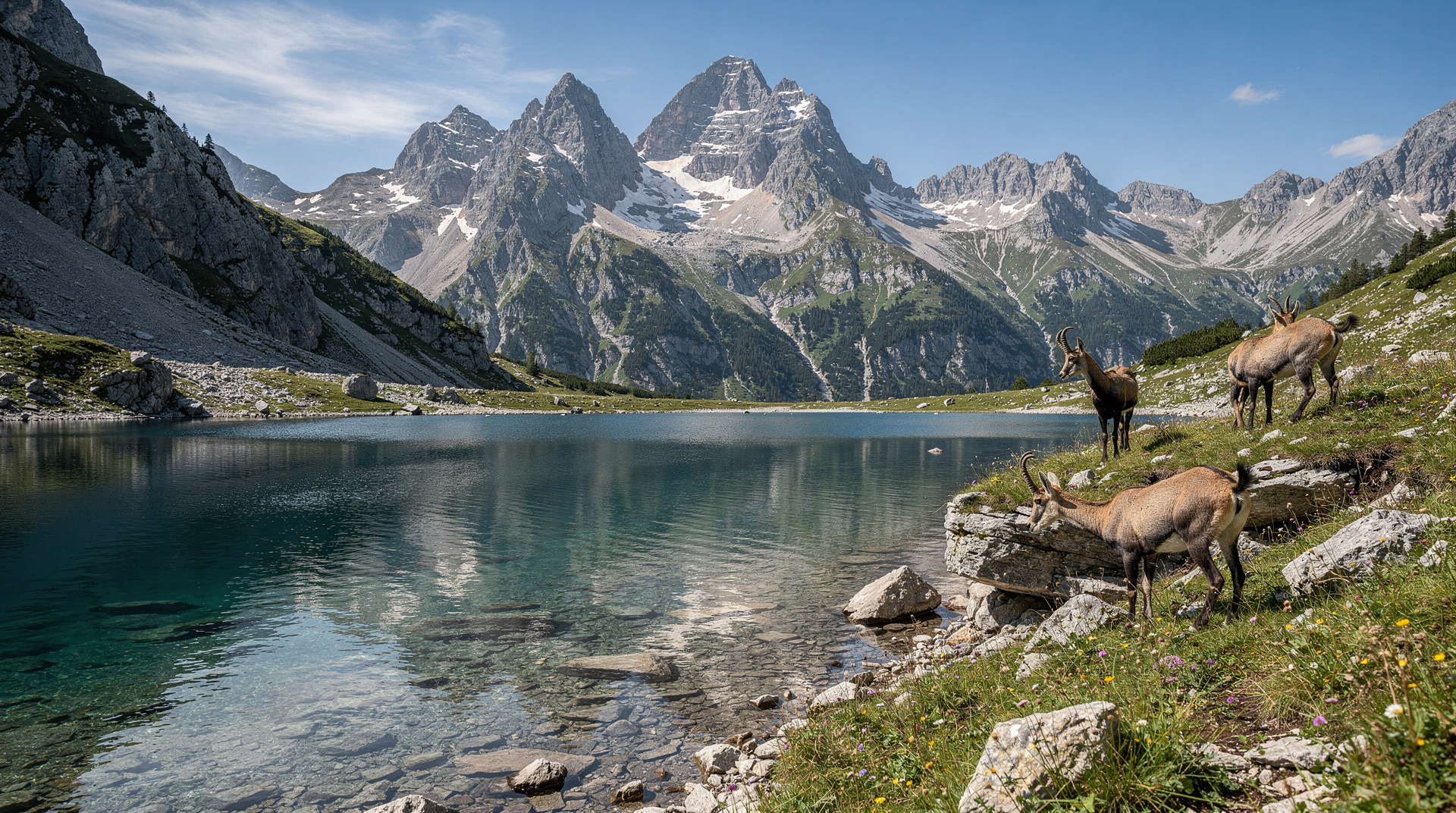
The Seven Lakes Valley continues above the waterfall in a serious Alpine hike (1400 m elevation gain) through glacially carved terrain with seven alpine lakes. A mountain hut midway makes it possible as a two-day hike with overnight accommodation.
4. Vintgar Gorge — easy
Distance: 4 km return
Time: 1h30
Access: 4 km north of Bled; car or cycle from the village
Note: closed November through April
Vintgar Gorge is a wooden walkway through a limestone gorge where the Radovna river has cut 1.6 km through the rock. The walk stays at river level; the walls rise to 200 m on each side. The water is the same turquoise as the Soča but on a smaller, more intimate scale.
The gorge ends at a large waterfall. Return via the hilltop path (30 min) offers views above the gorge from above.
5. Soča Trail section, Trenta to Bovec — moderate
Distance: 25 km one way (or any shorter section)
Time: 7-8h full length; 2-3h for the Trenta section
Access: Multiple points along the Soča Valley
The Soča Trail follows the river from its source in the Triglav National Park through the valley to Bovec. The upper section from the source to Trenta (10 km) is the most remote and wildest; the Trenta to Soča section (8 km) is more accessible and scenically outstanding.
Walking the river at water level — often only 2-3 m above the turquoise flow — for extended distances is an experience that the roadside views do not fully communicate.
6. Triglav from the south (Krma valley route) — strenuous, requires experience
Distance: 20 km return
Time: 10-12h
Access: Mojstrana, 9 km east of Kranjska Gora
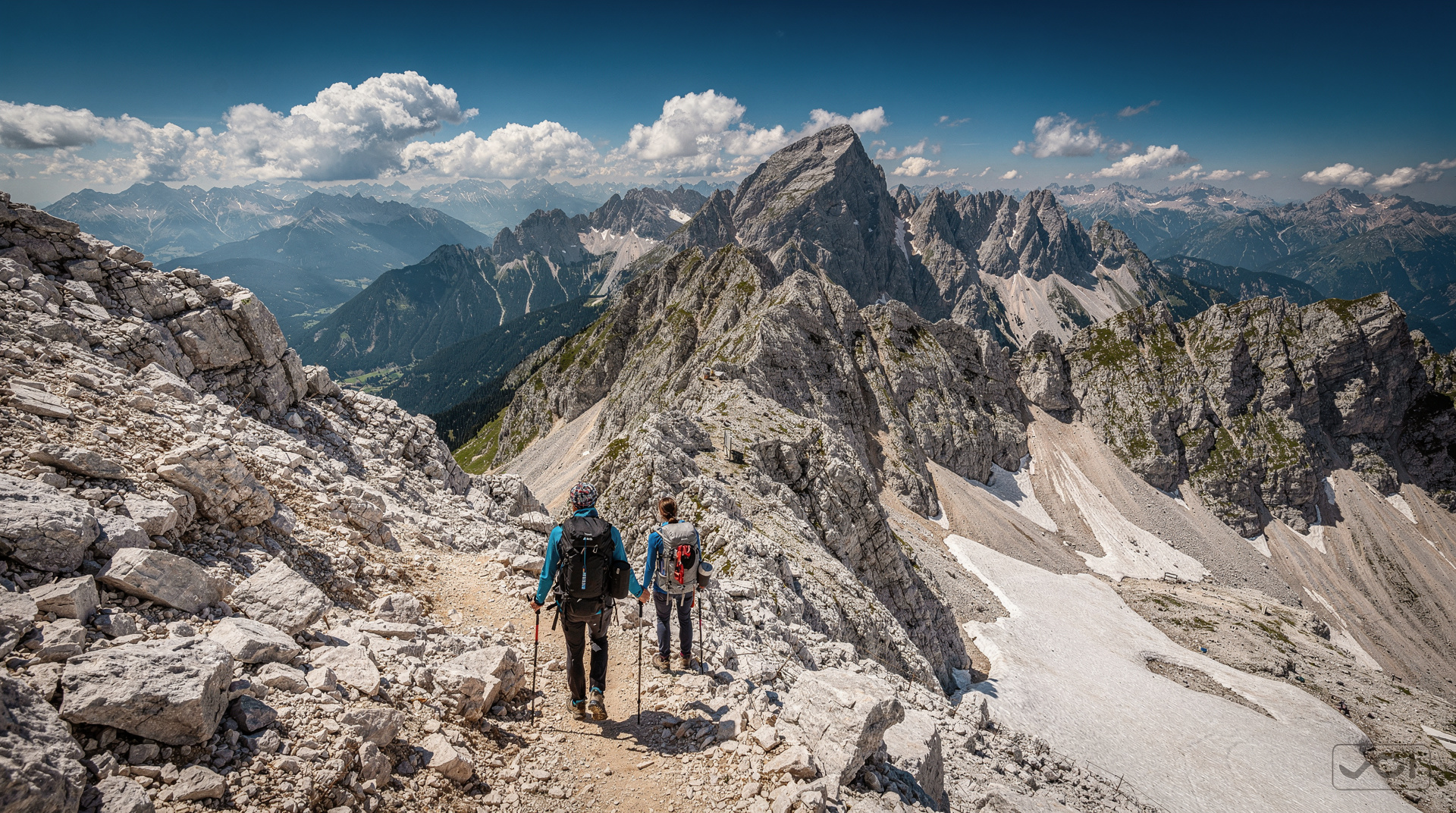
Climbing Triglav (2864 m) is the national rite of passage for Slovenians — every self-respecting local adult has climbed it at least once. For visitors, it is a serious undertaking requiring a full day, appropriate fitness, proper footwear, and ideally some previous experience of exposed Alpine terrain.
The Krma Valley route is the longest but least technical approach. The summit involves some fixed-rope sections (via ferrata elements) and exposed ridgeline walking. The view from the top, on a clear day, extends across all of Slovenia and into Austria, Italy, Croatia and Hungary.
Do not attempt this in poor weather, with inadequate footwear, or in the late season (snow on the upper sections from October). Our climbing Triglav guide has the full logistics.
7. Mangart Saddle to summit — strenuous
Distance: 4 km return from the saddle
Time: 2h return from saddle; add 1h for the drive from Bovec
Access: Mangart road from Bovec (vertiginous single track, not for nervous drivers)
The Mangart Saddle at 2055 m is reachable by car (highest road in Slovenia). From the saddle, the summit of Mangart (2679 m) is a 2h return hike on marked but steep terrain. The summit panorama spans the Soča Valley below and the Italian and Austrian Alps in three directions.
8. Pokljuka to Vogar — easy-moderate
Distance: 8 km circuit
Time: 3h
Access: Pokljuka Plateau, above Lake Bohinj; road accessible from Bled side
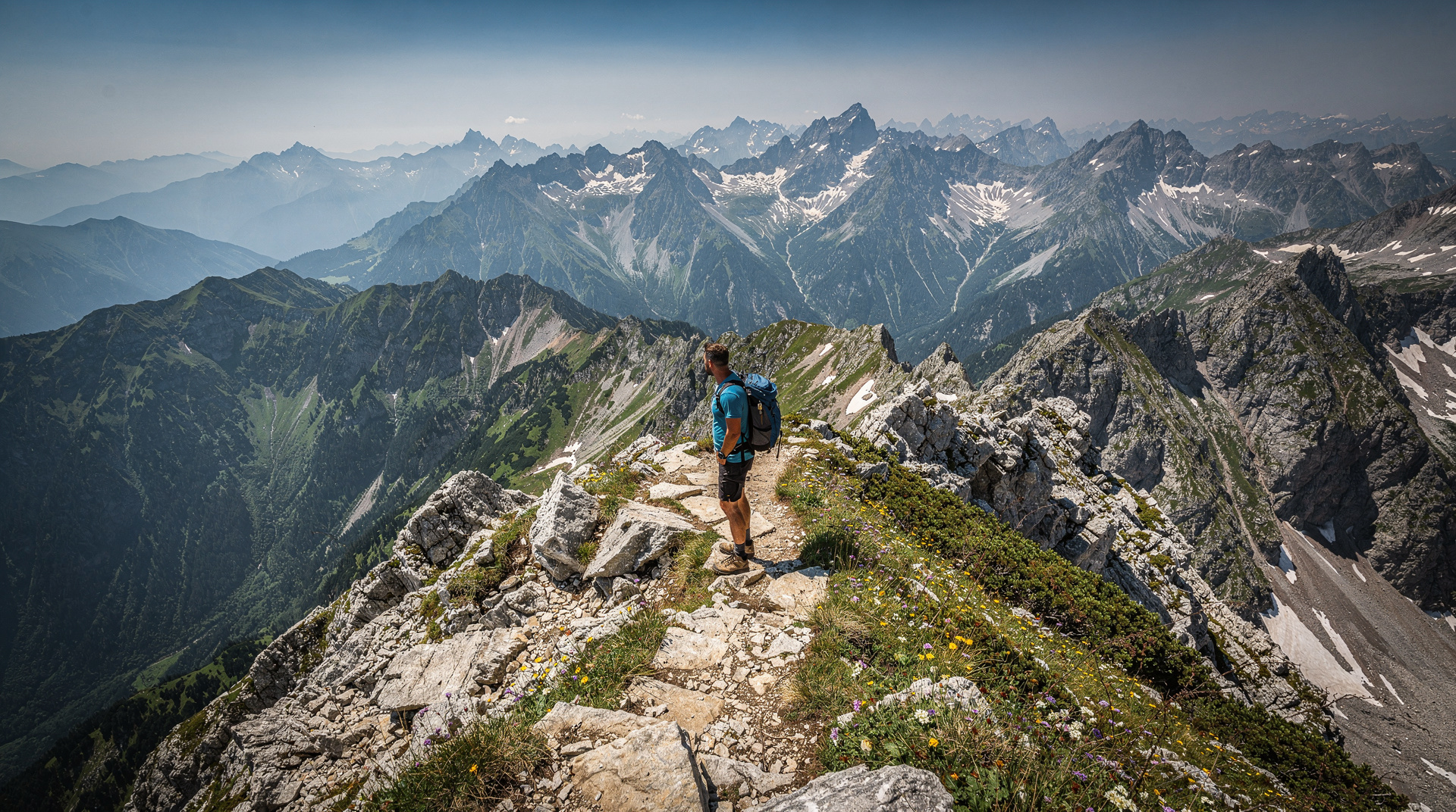
The Pokljuka Plateau at 1300 m is a forested high plateau inside Triglav National Park. The circular route to the Vogar viewpoint above Lake Bohinj passes through old spruce forest before emerging onto a ridge with views of the lake 800 m below and the surrounding peaks.
This is a gentler Alpine walk that rewards the views without requiring serious commitment.
9. Logar Valley to Rinka Waterfall — easy
Distance: 3 km return
Time: 1h30
Access: End of Logar Valley road; entry fee applies in summer
The Rinka Waterfall at the head of Logar Valley is a 90-metre cascade emerging from a cirque of Alpine peaks. The walk from the end of the valley road is flat and accessible. The landscape around it — an enclosed glacial amphitheatre — is the most dramatic in the Kamnik-Savinja Alps.
10. Velika Planina circuit — easy-moderate
Distance: 6 km circuit on the plateau
Time: 2h
Access: Cable car from Kamnik (€15 return), then chairlift
Velika Planina at 1666 m is a working shepherd’s plateau reached by cable car from Kamnik. The circuit walk passes the wooden hut village (occupied by herders in summer), through alpine meadows, and to viewpoints overlooking the Ljubljana Basin.
This combines accessible hiking with genuine cultural interest — the painted hut exteriors and the summer herding practice are living continuities with a tradition centuries old.
Matching the hike to your fitness and time
| Route | Difficulty | Time needed | Best for |
|---|---|---|---|
| Lake Bled circumference | Easy | 1h45 | Anyone, including families |
| Vintgar Gorge | Easy | 1h30 | First-timers wanting a guaranteed payoff |
| Savica Waterfall | Easy | 1h | Combining with a Bohinj day trip |
| Pokljuka to Vogar | Easy-moderate | 3h | A gentler alpine taste without commitment |
| Soča Trail (Trenta section) | Moderate | 2-3h | River-level scenery without summit exposure |
| Triglav (Krma valley) | Strenuous | 10-12h | Experienced hikers only, good weather essential |
If a guided introduction to the Julian Alps trail network sounds more appealing than route-finding alone on a first visit, a small-group hiking day trip from Bled covers several of the easier routes above with a local guide:
Julian Alps guided hiking day trip from BledPlanning your walks
The best hikes guide and the Julian Alps hiking guide cover the northern region in depth. For route conditions, the Triglav National Park guide has current information on seasonal closures and via ferrata conditions.
Walking poles are useful on the steeper descents. The packing guide has a full equipment checklist. Weather in the mountains changes quickly in summer — afternoon thunderstorms are common June through August. Start early and be off exposed ridgelines by 2pm.
Four more day hikes worth mentioning
Tosc above Bohinj (1913 m): a 5-6 hour return hike from the northern side of Lake Bohinj via Blato hamlet. The summit provides a view into the interior of the Triglav National Park that few visitors reach. Moderately difficult; good trail markings.
Sitar above Tolmin: a 3-hour circuit above Tolmin that rises from the valley floor to a ridge with views of the Soča Valley north toward Bovec and south toward Nova Gorica. Quiet; excellent wildflowers in May-June.
Olševa above Logar Valley: a 4-hour return hike above the head of the Logar Valley, crossing the Kamnik-Savinja main ridge and descending briefly into Austria before returning. The view from the ridge encompasses both Slovenia and Austrian Carinthia.
Snežnik (1796 m): the highest summit in the Dinaric region of Slovenia, accessible from the Notranjska plateau south of Ljubljana. A 3-4 hour return hike from the Sviščaki mountain hut. Isolated, rarely visited by foreign tourists, and offering a very different landscape character from the Julian Alps — forested karst plateau rather than bare limestone peaks.
The hut culture: mountain huts as trail infrastructure
The planinski dom (mountain hut) system is what makes multi-day and longer day hiking in Slovenia practical. The huts provide meals, accommodation in dormitories or double rooms (book in advance for summer weekends), and weather shelter on exposed ridges.
The quality ranges from basic shelter huts with sleeping platforms and a single wood stove to full-service huts with cooked meals, bar service, and multiple sleeping rooms. The mid-category is most common: a kitchen serving goulash, soup, sausages and hot drinks; bunk dormitories for 10-20 people; communal washing facilities.
Prices are regulated by the Alpine Association: a dormitory bunk costs approximately €12-18/night; a simple meal (goulash and bread) costs €6-10. Bring cash — most huts do not accept cards.
The Alpine Association of Slovenia (PZS) maintains the hut directory with opening dates, contact information, and current conditions for all registered huts. This is the practical reference for planning any overnight or multi-day hike.
What to pack, honestly
Sturdy footwear with ankle support matters more in Slovenia than in most European hiking destinations — the limestone terrain is frequently loose gravel over rock, even on marked “easy” trails like the Rinka Waterfall walk. A 20-30 litre daypack covers a full day: water (2 litres minimum in summer), a layer for sudden weather changes, sun protection, and cash for hut meals. Walking poles are genuinely useful on the steeper descents (Ojstrica, the Seven Lakes Valley) rather than an affectation. The packing guide has the complete list adapted to season.
Safety and mountain rescue
Mountain rescue in Slovenia is operated by the Gorska reševalna služba (GRS), part of the Mountain Rescue Association. The service operates helicopter and ground teams across all the Alpine and pre-Alpine regions.
The emergency number for mountain rescue is 112 (general emergency, mountain rescue automatically dispatched for mountain incidents). The GRS operates free of charge; travel insurance with mountain rescue coverage is recommended but rescue will not be withheld for lack of insurance.
Trail register boxes are available at many trailheads — write your route and expected return time. This simple action significantly improves response time if something goes wrong.
For self-guided hikers on more serious routes (Triglav, Mangart, the Bohinj crests), registering your route with your accommodation and leaving a planned return time is standard practice. The Julian Alps hiking guide covers safety protocols specific to the main hiking areas.
When to hike in Slovenia
May-June: alpine meadows at peak, rivers full, snowfields still on the high peaks creating dramatic visual contrast. Best for flower photography. The highest routes (above 2000 m) may still have snow; check conditions.
July-August: warmest and driest conditions. Most reliable for summit ascents. Busy at the most-visited viewpoints and trails; quieter on the less-known routes.
September: arguably the best hiking month for most visitors. Weather remains stable, crowds drop, the first hints of autumn colour appear in the forests. Temperature range is comfortable for sustained walking.
October: lower trails remain accessible and are in autumn colour. Above 1600 m, early snowfalls are possible. The high routes require caution from mid-October.